

Architecture as Building Systems
Studio Co-ordinators : Dipti Bhaindarkar, Abhijit Ekbote, Milind Mahale &
Samidha Kowli Shah
Saanvi Kulkarni
There are, in theory, many ways to understand a building. They can be a collection of spaces, interplays between light and shadow, inherent creators of movement patterns. Through this module, the goal was to read a building as an interconnected system of energy, material resources, and integrated systems. To be truly efficient, it is necessary for a built form to be able to work in harmony with its surroundings, generating an environment that fits into its contextual landscape while also serving the specific purpose it was designed for.

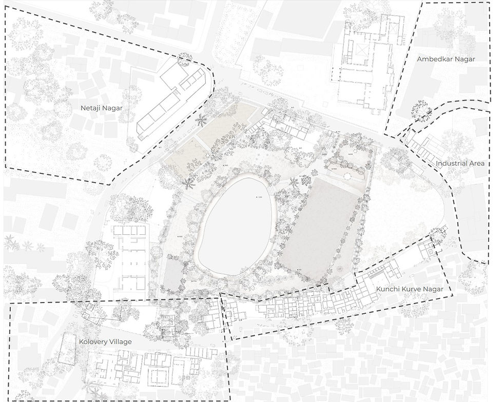
The site chosen for redesign was the Gyan Sagar Amphitheatre in Borivali, a multifunctional public space that encourages community interaction, cultural expression, and sustainable design. We began by mapping the area using a mix of technology and manual measurement – experimenting with electronic theodolites for leveling, and creating maps of the foliage present on site. Simultaneously, we learned how to represent all this data in digital formats, using a combination of softwares to create an overall picture of the site, its usage, and features unique to it that we would have to consider while proposing our redesign. To ensure that sustainability and reuse of existing resources were the forefront of this exercise, we chose a specific resource system to focus on – examples include water recycle, solar power, and land modulation. This meant that rather than simply remaking programs, our designs would be uniquely suited to the landscape we intended for it to be constructed in, and would be able to maximise the efficiency of whichever features we chose to retain.

Besides just the external design of a building, it is essential to understand the systems that make it up – lectures that addressed the design of water, electrical, and acoustic mechanisms helped us better integrate the resource system we had chosen. Additionally, we engaged with several readings about the meaning, development, and usage of ‘typology’ in architectural design – what defines the ‘nature’ of a building? Is it possible to break down the ontology of a space, to understand its position in not just society, but as a ‘form’ of existence? In the journal Oppositions, Anthony Vidler defines a city as “[...] always political in its essence. The fragmentation and re-composition of its spatial and institutional forms thereby can never be separated from the political implications”. Being able to ‘break down’ our objectively large site into diagrams, typologies, and systems gave us a more comprehensive understanding of how we could approach its redesign.

Amidst this, we engaged in a short field visit to Nashik that helped us see all these concepts come to life. Our first destination, Dhananjay Shinde’s architectural studio, showed us that an ‘office’ doesn’t have to be confined to a single, templated setup. A workspace can come in many forms, and creating an environment that facilitates both productivity and creative inspiration requires intentionality. We also visited the Pandav Leni caves, a collection of 24 rock-cut Buddhist viharas with an intricately engineered drainage system – showing us that history can contain inspiration in unexpected places. Through this trip, we were able to engage with our surroundings while also understanding how they worked within the context of a different city.

With this knowledge in mind, we began the actual production process – creating digital plans, sections, and physical models of each program. With a defined seating capacity and set of functions, the main task was to ensure that our chosen resource system was able to work with the changes we were proposing. The models helped us define the spatial logic of our designs, along with encouraging us to try out new materials and methods of representation. The module concluded with detailed presentations of our designs, the systems that upheld them, and their placement on the site. Overall, this experience left us with several new learnings about how to approach form through systems, historical knowledge, and resource efficiency.



Comments