

Settlement Study - Kalitala, Sundarbans
- Dishika More
- Jan 12, 2025
- 4 min read
Studio Co-ordinator: Anuj Daga, Rupali Gupte, Manish Shravane, Manasvi Patil
Dishika More
The settlement study course was conducted in Kalitala, a small village in the Sundarbans region , where we got an understanding of the problems faced by the community due to climate change. We also explored how the changing landscape, shaped by rising sea levels and shifting weather patterns, has forced the community to adapt to new ways of living. From adopting innovative farming techniques to modifying their homes to withstand frequent flooding and cyclones like ‘Illa’.
The Sundarbans, the world’s largest mangrove forest, spans Bangladesh and India, formed by the Ganges, Brahmaputra, and Meghna rivers. It hosts rich biodiversity and a unique tidal ecosystem. However, human activities, deforestation, and reduced freshwater flow threaten its ecological balance, increasing salinity and habitat loss.

The Sundarbans has a long history of human habitation, dating back to at least 150,000 BC, with mentions in ancient texts like the Mahabharata. Early settlers, including Proto-Australoid and Aryan groups, engaged in agriculture, which expanded significantly during the Gupta period. The Mughal era (1575–1765) saw extensive deforestation and rising salinity due to river shifts. British colonization (1757–1947) accelerated land reclamation for timber, agriculture, and salt farming, leading to the clearance of over 5,100 km² of forests by 1873. The Forest Act of 1855 later designated parts of the Sundarbans as reserved forests, imposing restrictions that continue today.

We focused our study on three sites within the village to gain a deeper understanding of the village’s structure and the daily lives of its inhabitants. By examining these areas closely, we were able to observe how the community interacts with its environment, the layout of homes and spaces, and the way residents adapt to their surroundings in their everyday routines.


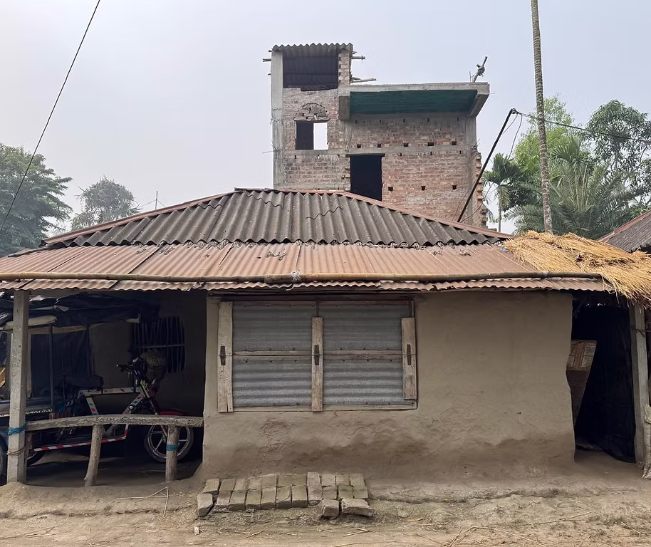
The first site was located in the village of Gobindakati, which shares a close boundary with Bangladesh, separated by the Kalindi River. Here, we observed a noticeable shift in the housing types, transitioning from traditional mud houses, which were built by the locals themselves, to concrete structures constructed under the Pradhan Mantri Awas Yojana (PMAY).
In front of these houses, the residents maintained kitchen gardens for self-consumption, alongside cow sheds and poultry houses, reflecting the community’s efforts to sustain themselves through small-scale farming and livestock.


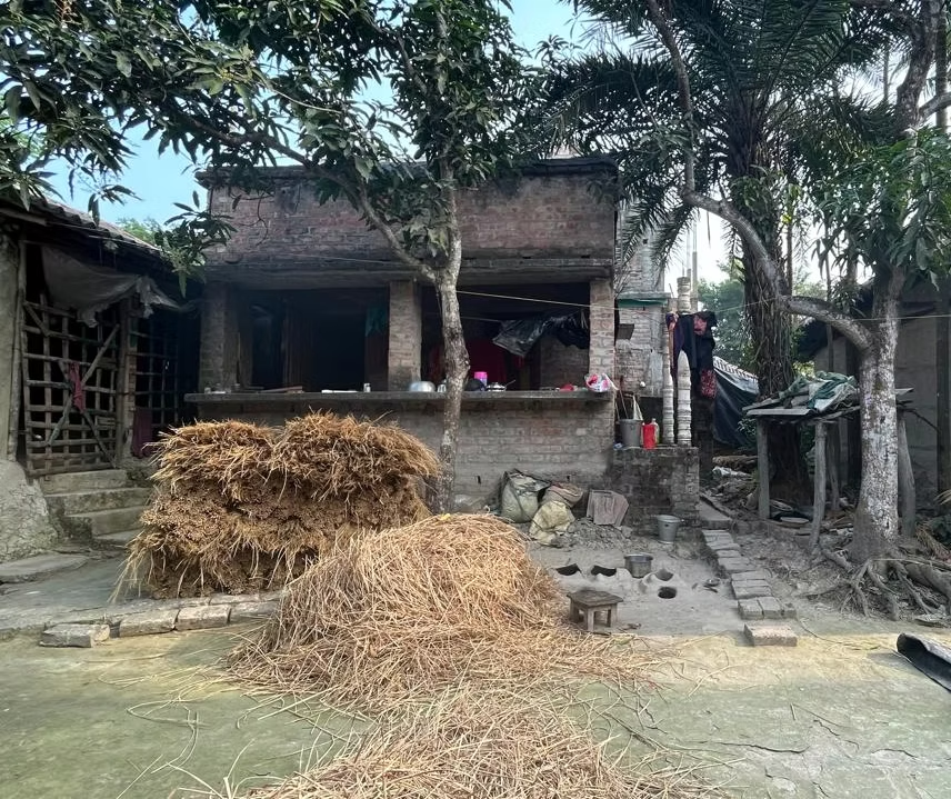
Our second site was a settlement located along an embankment, strategically built to protect the area from flooding and tidal surges. These embankments not only serve as a vital defense against rising waters but also shape the way the community lives and works.
The houses in this area are typically surrounded by pukurs (ponds), which are man-made water bodies formed by the excavation of mud and earth during the construction of the houses. These ponds are multifunctional, they act as reservoirs for water, regulate the microclimate of the area, and contribute to the aesthetic and practical layout of the settlement.
The pukur has a profound impact on the livelihoods of the community. Fishing, aquaculture, and farming have become the predominant occupations. These pukurs are often used to raise fish, providing a steady source of income and food for the residents. Additionally, the fertile lands surrounding the ponds, enriched by the silt and organic matter deposited over time, support agricultural activities. This close integration of water resources into their daily lives highlights a harmonious and sustainable relationship between the people and their environment, blending traditional wisdoms and practical needs.
The third site, known as the forest-side settlement, lies just 1.5 km from the zero point at the India-Bangladesh border. This location is particularly vulnerable due to its direct exposure to saline water, which poses a significant threat to the residents’ homes and livelihoods. The constant contact with saline water gradually erodes the mud plinths of houses, compromising their structural stability and increasing the risk of collapse. Additionally, the salinity of the water seeps into the surrounding soil, rendering it infertile and unsuitable for growing vegetables. This severely impacts the residents’ ability to maintain kitchen gardens, which are crucial for both self-sufficiency and generating income by selling produce in local markets.
Despite these challenges, the community’s proximity to the forest shapes their daily lives and livelihoods. The forest serves as a vital resource, and the residents maintain a close-knit relationship with it. Many villagers rely on the forest for sustenance, venturing into it to catch mud crabs and fish, which they sell in the market to earn a living. This dependence on the forest reflects not only the economic importance of the natural ecosystem but also the deep connection between the community and their environment.

The Sundarbans faces relentless environmental challenges, from rising seas and cyclones to increasing salinity, forcing its people to adapt. Many are shifting from traditional mud houses to concrete homes, often through government schemes like PMAY, though inadequate funding and structural issues pose new risks. Cyclone shelters provide temporary refuge, while architects propose stilted homes as long-term solutions, though villagers remain hesitant. Younger generations seek opportunities beyond the mangroves, but migration and poor government support weaken local education and employment.


Comments